Category:Humptulips River
Jump to navigation
Jump to search
tributary to Grays Harbor in Grays Harbor County, Washington state, United States of America  | |||||
| Upload media | |||||
| Instance of | |||||
|---|---|---|---|---|---|
| Located in protected area |
| ||||
| Location |
| ||||
| Length |
| ||||
| Elevation above sea level |
| ||||
| Mouth of the watercourse | |||||
| Drainage basin |
| ||||
| Tributary |
| ||||
 | |||||
Media in category "Humptulips River"
The following 10 files are in this category, out of 10 total.
-

-

-

-

-
 Humptulips River (1).jpg 2,100 × 1,500; 785 KB
-

-
 Humptulips River.jpg 900 × 600; 176 KB
-
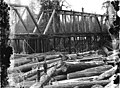
 Log jam on the Humptulips River, Washington, 1909 (INDOCC 377).jpg 768 × 568; 101 KB
-
 Log jam on the Humptulips River, Washington, 1909 (INDOCC 536).jpg 768 × 552; 132 KB
-


.jpeg)
.jpeg)
.jpg)
.jpg)
.jpg)
.jpg)
.jpg)